About the Proposed Development

We held a statutory public consultation on our updated proposals for the UK element of the Xlinks Morocco-UK Power Project (the ‘Project’) between 16 May and 11 July 2024. You can find the information we published as part of the consultation on this page.

Securing development consent

Last year, the Secretary of State for Energy Security and Net Zero recognised the elements of the Project in the UK (the ‘Proposed Development’) as nationally significant and requiring development consent under section 35 of the Planning Act 2008. This recognised the major contribution it could make to the country’s need for clean, secure and reliable energy.

The change means we need to apply for a Development Consent Order (DCO) from the Secretary of State to construct and operate the Proposed Development, rather than seeking planning permission from Torridge District Council.

The DCO application process is managed by the Planning Inspectorate on behalf of the Secretary of State. You can find out more information about the DCO process by visiting the Planning Inspectorate’s website: infrastructure.planninginspectorate.gov.uk

Consultation

Consultation is an important part of the DCO process as it enables the public and stakeholders to comment on the proposals. We have conducted three rounds of consultation, which have been vital to shaping our proposals to date.

Most recently, we carried out a round of consultation from 16 May to 11 July 2024. This was called a ‘statutory public consultation’ because it fulfilled the legal requirement to consult on nationally significant projects. As part of the consultation, we held events in the local area and online, published information about our proposals, and invited feedback from stakeholders and the community.

We are grateful to everyone who took part in the consultation. The feedback we have received will help us to refine our proposals before we submit a DCO application. All feedback received will be summarised and responded to in the Consultation Report, which will form part of our DCO application.

Document library

This section includes the documents we published as part of our statutory public consultation, which took place between 16 May and 11 July 2024.

Document library
Consultation Booklet
Exhibition Boards
Statement of Community Consultation
Order limits plan - onshore
Order limits plan
Land Use Plans
Section 48 notice
Programme document
Preliminary Environmental Information Report - Non-Technical Summary
Xlinks MUPP_PEIR_Non-Technical Summary
Xlinks MUPP_PEIR_NTS_Figure 1
Xlinks MUPP_PEIR_NTS_Figure 2
Preliminary Environmental Information Report - Volume 1
Xlinks MUPP_PEIR_Volume 1_Chapter Cover & Contents
Xlinks MUPP_PEIR_Volume 1_Chapter 1_Introduction
Xlinks MUPP_PEIR_Volume 1_Chapter 2_Policy and Legislation
Xlinks MUPP_PEIR_Volume 1_Chapter 3_Project Description
Xlinks MUPP_PEIR_Volume 1_Chapter 4_Need and Alternatives
Xlinks MUPP_PEIR_Volume 1_Chapter 5_EIA Methodology
Preliminary Environmental Information Report - Volume 1 - Appendices
Xlinks MUPP_PEIR_Volume 1_Appendix Cover & Contents List
Xlinks MUPP_PEIR_Volume 1_Appendix 1.1_Statement of Expertise
Xlinks MUPP_PEIR_Volume 1_Appendix 3.1_Draft Mitigation Schedule
Xlinks MUPP_PEIR_Volume 1_Appendix 3.2_Outline Onshore CEMP
Xlinks MUPP_PEIR_Volume 1_Appendix 3.3_Outline Offshore CEMP
Xlinks MUPP_PEIR_Volume 1_Appendix 3.4_Onshore Crossing Schedule
Xlinks MUPP_PEIR_Volume 1_Appendix 5.1_Scoping Responses
Xlinks MUPP_PEIR_Volume 1_Appendix 5.2_Transboundary Screening
Xlinks MUPP_PEIR_Volume 1_Appendix 5.3_CEA Screening Matrix
Xlinks MUPP_PEIR_Volume 1_Appendix Cover & Contents List
Preliminary Environmental Information Report - Volume 1 - Figures
Xlinks MUPP_PEIR_Volume 1_Figures List
Xlinks MUPP_PEIR_Volume 1_Figure 1.1
Xlinks MUPP_PEIR_Volume 1_Figure 1.2
Xlinks MUPP_PEIR_Volume 1_Figure 3.1
Xlinks MUPP_PEIR_Volume 1_Figure 3.2
Xlinks MUPP_PEIR_Volume 1_Figure 3.3
Xlinks MUPP_PEIR_Volume 1_Figure 3.4
Xlinks MUPP_PEIR_Volume 1_Figure 3.5
Xlinks MUPP_PEIR_Volume 1_Figure 3.6
Xlinks MUPP_PEIR_Volume 1_Figure 3.7
Xlinks MUPP_PEIR_Volume 1_Figure 3.8
Xlinks MUPP_PEIR_Volume 1_Figure 3.9
Xlinks MUPP_PEIR_Volume 1_Figure 3.10
Xlinks MUPP_PEIR_Volume 1_Figure 4.1
Xlinks MUPP_PEIR_Volume 1_Figure 4.2
Xlinks MUPP_PEIR_Volume 1_Figure 4.3
Xlinks MUPP_PEIR_Volume 1_Figure 4.4
Xlinks MUPP_PEIR_Volume 1_Figure 4.5
Preliminary Environmental Information Report - Volume 2
Xlinks MUPP_PEIR_Volume 2_Chapter List
Xlinks MUPP_PEIR_Volume 2_Chapter 1_Ecology and Nature Conservation
Xlinks MUPP_PEIR_Volume 2_Chapter 2_Historic Environment
Xlinks MUPP_PEIR_Volume 2_Chapter 3_Hydrology and Flood Risk
Xlinks MUPP_PEIR_Volume 2_Chapter 4_Ground Conditions
Xlinks MUPP_PEIR_Volume 2_Chapter 5_Traffic and Transport
Xlinks MUPP_PEIR_Volume 2_Chapter 6_Noise and Vibration
Xlinks MUPP_PEIR_Volume 2_Chapter 7_Air Quality
Xlinks MUPP_PEIR_Volume 2_Chapter 8_Land Use and Recreation
Preliminary Environmental Information Report - Volume 2 - Appendices
Xlinks MUPP_PEIR_Volume 2_Appendix List
Xlinks MUPP_PEIR_Volume 2_Appendix 1.1_Phase 1 Habitat Survey
Xlinks MUPP_PEIR_Volume 2_Appendix 1.2_Ecological Desk Study
Xlinks MUPP_PEIR_Volume 2_Appendix 1.3_Hazel Dormouse Survey
Xlinks MUPP_PEIR_Volume 2_Appendix 1.4_Bat Activity Survey
Xlinks MUPP_PEIR_Volume 2_Appendix 1.5_Bat Roost Survey
Xlinks MUPP_PEIR_Volume 2_Appendix 1.6_Otter and Water Vole Survey (Public)
Xlinks MUPP_PEIR_Volume 2_Appendix 1.7_Badger Survey (Public)
Xlinks MUPP_PEIR_Volume 2_Appendix 1.8_Breeding, Wintering and Migratory Bird Report
Xlinks MUPP_PEIR_Volume 2_Appendix 1.9_Reptile Survey
Xlinks MUPP_PEIR_Volume 2_Appendix 1.10_Aquatic Invertebrates
Xlinks MUPP_PEIR_Volume 2_Appendix 1.11_River Condition Assessments
Xlinks MUPP_PEIR_Volume 2_Appendix 1.12_Natural England's DAS Meeting Notes
Xlinks MUPP_PEIR_Volume 2_Appendix 2.1_DBA
Xlinks MUPP_PEIR_Volume 2_Appendix 2.2_Preliminary Geophysical Survey Report
Xlinks MUPP_PEIR_Volume 2_Appendix 2.3_Preliminary Trial Trenching Report
Xlinks MUPP_PEIR_Volume 2_Appendix 3.1_Flood Risk Assessment
Xlinks MUPP_PEIR_Volume 2_Appendix 3.2_Preliminary Onshore WFD Assessment
Xlinks MUPP_PEIR_Volume 2_Appendix 3.3_Abstractions and Discharges
Xlinks MUPP_PEIR_Volume 2_Appendix 4.1_DTS, PRA and Site Reconnaissance
Xlinks MUPP_PEIR_Volume 2_Appendix 6.1_Baseline Sound Survey
Xlinks MUPP_PEIR_Volume 2_Appendix 6.2_Construction Noise and Vibration
Xlinks MUPP_PEIR_Volume 2_Appendix 6.3_Operational Noise
Xlinks MUPP_PEIR_Volume 2_Appendix 8.1_Agricultural Land Classification
Preliminary Environmental Information Report - Volume 2 - Figures
Xlinks MUPP_PEIR_Volume 2_Figures List
Xlinks MUPP_PEIR_Volume 2_Figure 1.1
Xlinks MUPP_PEIR_Volume 2_Figure 1.2
Xlinks MUPP_PEIR_Volume 2_Figure 1.3
Xlinks MUPP_PEIR_Volume 2_Figure 2.1-2.3
Xlinks MUPP_PEIR_Volume 2_Figure 3.1
Xlinks MUPP_PEIR_Volume 2_Figure 3.2
Xlinks MUPP_PEIR_Volume 2_Figure 3.3
Xlinks MUPP_PEIR_Volume 2_Figure 3.4
Xlinks MUPP_PEIR_Volume 2_Figure 3.5
Xlinks MUPP_PEIR_Volume 2_Figure 3.6
Xlinks MUPP_PEIR_Volume 2_Figure 3.7
Xlinks MUPP_PEIR_Volume 2_Figure 3.8
Xlinks MUPP_PEIR_Volume 2_Figure 5.1
Xlinks MUPP_PEIR_Volume 2_Figure 5.2
Xlinks MUPP_PEIR_Volume 2_Figure 5.3
Xlinks MUPP_PEIR_Volume 2_Figure 5.4
Xlinks MUPP_PEIR_Volume 2_Figure 5.5
Xlinks MUPP_PEIR_Volume 2_Figure 5.6
Xlinks MUPP_PEIR_Volume 2_Figure 5.7
Xlinks MUPP_PEIR_Volume 2_Figure 6.1
Xlinks MUPP_PEIR_Volume 2_Figure 6.2
Xlinks MUPP_PEIR_Volume 2_Figure 6.3
Xlinks MUPP_PEIR_Volume 2_Figure 7.1
Xlinks MUPP_PEIR_Volume 2_Figure 7.2
Xlinks MUPP_PEIR_Volume 2_Figure 7.3
Xlinks MUPP_PEIR_Volume 2_Figure 8.1
Xlinks MUPP_PEIR_Volume 2_Figure 8.2
Xlinks MUPP_PEIR_Volume 2_Figure 8.2a
Xlinks MUPP_PEIR_Volume 2_Figure 8.3
Xlinks MUPP_PEIR_Volume 2_Figure 8.4
Xlinks MUPP_PEIR_Volume 2_Figure 8.5
Xlinks MUPP_PEIR_Volume 2_Figure 8.6
Xlinks MUPP_PEIR_Volume 2_Figure 8.7
Preliminary Environmental Information Report - Volume 3
Xlinks MUPP_PEIR_Volume 3_Chapter List
Xlinks MUPP PEIR Vol 3 Chapter 1 Benthic v5.0 - FINAL
Xlinks MUPP PEIR Vol 3 Chapter 2 F&S v4.0 - FINAL
Xlinks MUPP PEIR Vol 3 Chapter 3 Commercial Fisheries v4.0 - FINAL
Xlinks MUPP PEIR Vol 3 Chapter 4 Marine mammals and sea turtles v6.0 - FINAL
Xlinks MUPP PEIR Vol 3 Chapter 5 Shipping and Navigation v5.0 - FINAL
Xlinks MUPP PEIR Vol 3 Chapter 6 OMU v5.0 - FINAL
Xlinks MUPP PEIR Vol 3 Chapter 7 Marine Archaeology v5.0 - FINAL
Xlinks MUPP PEIR Vol 3 Chapter 8 Physical Processes_v4.0 - FINAL
Xlinks MUPP PEIR Vol 3 Chapter 9 Offshore Ornithology v5.0 - FINAL
Preliminary Environmental Information Report - Volume 3 - Appendices
Xlinks MUPP_PEIR_Volume 3_Appendix List
Xlinks MUPP PEIR Vol 3 Appendix 1.1 WFD Assessment v2.0 - FINAL
Xlinks MUPP PEIR Vol 3 Appendix 3.1 Commercial fisheries baseline v2.0 - FINAL
Xlinks MUPP PEIR Vol 3 Appendix 4.1 Underwater Noise v4.0 - FINAL
Xlinks MUPP PEIR Vol 3 Appendix 5.1 NRA v3.0 - FINAL
Xlinks MUPP PEIR Vol 3 Appendix 7.1 Geoarch v3.0 - FINAL
Xlinks MUPP PEIR Vol 3 Appendix 7.2 OAWSI v4.0 - FINAL
Xlinks MUPP PEIR Vol 3 Appendix 8.1 Xlinks_Sediment Dispersion TN_v1.0
Xlinks MUPP PEIR Vol 3 Appendix 8.2 Xlinks Wave & Tidal Conditions TN_21-03-24_v.01
Xlinks MUPP PEIR Vol 3 Appendix 8.3 Xlinks Sediment Sample Chemistry Results_21-03-24_v.01
Xlinks MUPP PEIR Vol 3 Appendix 8.4 GEOxyz Environmental Report
Preliminary Environmental Information Report - Volume 3 - Figures
Xlinks MUPP_PEIR_Volume 3_Figures List
Xlinks MUPP_PEIR_Vol 3 Fig 1.1 - Study Area
Xlinks MUPP_PEIR_Vol 3 Fig 1.2 - EU Sea Map (2023)
Xlinks MUPP_PEIR_Vol 3 Fig 1.3 - Benthic Macrofaunal Assemblages (Biotopes)
Xlinks MUPP_PEIR_Vol 3 Fig 1.4 - Designated Sites with Benthic Features
Xlinks MUPP_PEIR_Vol 3 Fig 1.5 - Sediment type - Sheet 1
Xlinks MUPP_PEIR_Vol 3 Fig 1.6 - Level 5 Biotope Classifications from Preliminary Survey Results
Xlinks MUPP_PEIR_Vol 3 Fig 1.7 - Mapped EUNIS level 4 and 5 habitats in the Offshore Cable Corridor (0-100km)
Xlinks MUPP_PEIR_Vol 3 Fig 1.8 - Mapped EUNIS level 4 and 5 habitats in the Offshore Cable Corridor (100-200km)
Xlinks MUPP_PEIR_Vol 3 Fig 1.9 - Mapped EUNIS level 4 and 5 habitats in the Offshore Cable Corridor (200-300km)
Xlinks MUPP_PEIR_Vol 3 Fig 1.10 - Mapped EUNIS level 4 and 5 habitats in the Offshore Cable Corridor (300-370km)
Xlinks MUPP_PEIR_Vol 3 Fig 1.11 - Bedrock Reef
Xlinks MUPP_PEIR_Vol 3 Fig 1.12 - Stony Reef
Xlinks MUPP_PEIR_Vol 3 Fig 2.1 - Study Area
Xlinks MUPP_PEIR_Vol 3 Fig 2.2 - Nursery and Spawning Grounds 1
Xlinks MUPP_PEIR_Vol 3 Fig 2.3 - Nursery and Spawning Grounds 2
Xlinks MUPP_PEIR_Vol 3 Fig 2.4 - Nursery and Spawning Grounds 3
Xlinks MUPP_PEIR_Vol 3 Fig 2.5 - Nursery and Spawning Grounds 4
Xlinks MUPP_PEIR_Vol 3 Fig 2.6 - Nursery and Spawning Grounds 5
Xlinks MUPP_PEIR_Vol 3 Fig 2.7 Sandeel Habitat Preference from Site-Specific Survey Data
Xlinks MUPP_PEIR_Vol 3 Fig 2.8 Designated sites within the Study Area
Xlinks MUPP_PEIR_Vol 3 Fig 3.1 Commercial Fisheries Study Area
Xlinks MUPP_PEIR_Vol 3 Fig 4.1 Seal_Study_Area
Xlinks MUPP_PEIR_Vol 3 Fig 4.2 Cetacean_Study_Area
Xlinks MUPP_PEIR_Vol 3 Fig 4.3 SeaTurtle_Study_Area
Xlinks MUPP_PEIR_Vol 3 Fig 5.1 Shipping and Navigation Study Area
Xlinks MUPP_PEIR_Vol 3 Fig 5.2 Navigational Features
Xlinks MUPP_PEIR_Vol 3 Fig 5.3 Navigational Features in Proximity to the Landfall
Xlinks MUPP_PEIR_Vol 3 Fig 5.4 AIS Vessel Tracks by Type (September 2022 - August 2023)
Xlinks MUPP_PEIR_Vol 3 Fig 5.5 AIS Vessel Density (September 2022-August 2023)
Xlinks MUPP_PEIR_Vol 3 Fig 5.6 Fishing Vessel by Gear Type (September 2022-August 2023)
Xlinks MUPP_PEIR_Vol 3 Fig 5.7 Recreational Vessel Density (September 2022-August 2023)
Xlinks MUPP_PEIR_Vol 3 Fig 5.8 RNLI Stations and Incidents (2013-2022)
Xlinks MUPP_PEIR_Vol 3 Fig 6.1 Study Area
Xlinks MUPP_PEIR_Vol 3 Fig 6.2 Offshore Wind
Xlinks MUPP_PEIR_Vol 3 Fig 6.3 Subsea_Cables
Xlinks MUPP_PEIR_Vol 3 Fig 6.4 Recreational_Diving_Sites
Xlinks MUPP_PEIR_Vol 3 Fig 6.5 Seaweed_Farm
Xlinks MUPP_PEIR_Vol 3 Fig 7.1 - Historical Environment - Offshore View - Sheets 1-5_v2
Xlinks MUPP_PEIR_Vol 3 Fig 7.2 - Historical Environment - Onshore View
Xlinks MUPP_PEIR_Vol 3 Fig 8.1 Physical Processes Assessment Study Area
Xlinks MUPP_PEIR_Vol 3 Fig 8.2 Environmental Designations1
Xlinks MUPP_PEIR_Vol 3 Fig 8.3 Environmental Designations2
Xlinks MUPP_PEIR_Vol 3 Fig 8.4 Bathymetry
Xlinks MUPP_PEIR_Vol 3 Fig 8.5 Locations of Water Level Data
Xlinks MUPP_PEIR_Vol 3 Fig 8.6 Locations of Wave Data
Xlinks MUPP_PEIR_Vol 3 Fig 8.7 Locations of Tidal Streams Data
Xlinks MUPP_PEIR_Vol 3 Fig 8.8 Locations of Sediment Data
Xlinks MUPP_PEIR_Vol 3 Fig 9.1 Study Area
Preliminary Environmental Information Report - Volume 4
Xlinks MUPP_PEIR_Volume 4_Chapter List
Xlinks MUPP_PEIR_Volume 4_Chapter 1_Climate Change
Xlinks MUPP_PEIR_Volume 4_Chapter 2_LSVIA
Xlinks MUPP_PEIR_Volume 4_Chapter 3_Socio-economics and Tourism
Xlinks MUPP_PEIR_Volume 4_Chapter 4_Human Health
Xlinks MUPP_PEIR_Volume 4_Chapter 5_Inter-related Effects
Preliminary Environmental Information Report - Volume 4 - Appendices
Xlinks MUPP_PEIR_Volume 4_Appendix List
Xlinks MUPP_PEIR_Volume 4_Appendix 1.1_GHG Technical Report
Xlinks MUPP_PEIR_Volume 4_Appendix 1.2_Climate Change Risk Assessment
Xlinks MUPP_PEIR_Volume 4_Appendix 2.1_SLVIA Planning Policy Context
Xlinks MUPP_PEIR_Volume 4_Appendix 2.2_Landscape Character Baseline Technical Report
Xlinks MUPP_PEIR_Volume 4_Appendix 2.3_Visual Baseline Technical Report
Xlinks MUPP_PEIR_Volume 4_Appendix 2.4_LSVIA Methodology
Xlinks MUPP_PEIR_Volume 4_Appendix 2.5_Landscape Visualisations
Preliminary Environmental Information Report - Volume 4 - Figures
Xlinks MUPP_PEIR_Volume 4_Figure List
Xlinks MUPP_PEIR_Volume 4_Figure 1.1
Xlinks MUPP_PEIR_Volume 4_Figure 2.1
Xlinks MUPP_PEIR_Volume 4_Figure 2.2
Xlinks MUPP_PEIR_Volume 4_Figure 2.3
Xlinks MUPP_PEIR_Volume 4_Figure 2.4
Xlinks MUPP_PEIR_Volume 4_Figure 2.5a
Xlinks MUPP_PEIR_Volume 4_Figure 2.5b
Xlinks MUPP_PEIR_Volume 4_Figure 2.5c
Xlinks MUPP_PEIR_Volume 4_Figure 2.5d
Xlinks MUPP_PEIR_Volume 4_Figure 2.5e
Xlinks MUPP_PEIR_Volume 4_Figure 2.6
Xlinks MUPP_PEIR_Volume 4_Figure 2.7
Xlinks MUPP_PEIR_Volume 4_Figure 3.1
Xlinks MUPP_PEIR_Volume 4_Figure 4.1

Morocco-UK Power Project Statutory Consultations

The recordings below are of the webinars we carried out during the statutory public consultation:

Webinar 29 May 2024

Webinar 5 June 2024

Notices

Development Consent Order (DCO) application update:

We can confirm we have submitted a Development Consent Order (DCO) application for the UK elements of the Morocco-UK Power Project. The Planning Inspectorate will now review our application.  For further information, please see the Planning Inspectorate’s webpage for the Proposed Development: https://national-infrastructure-consenting.planninginspectorate.gov.uk/projects/EN010164.

Survey update:

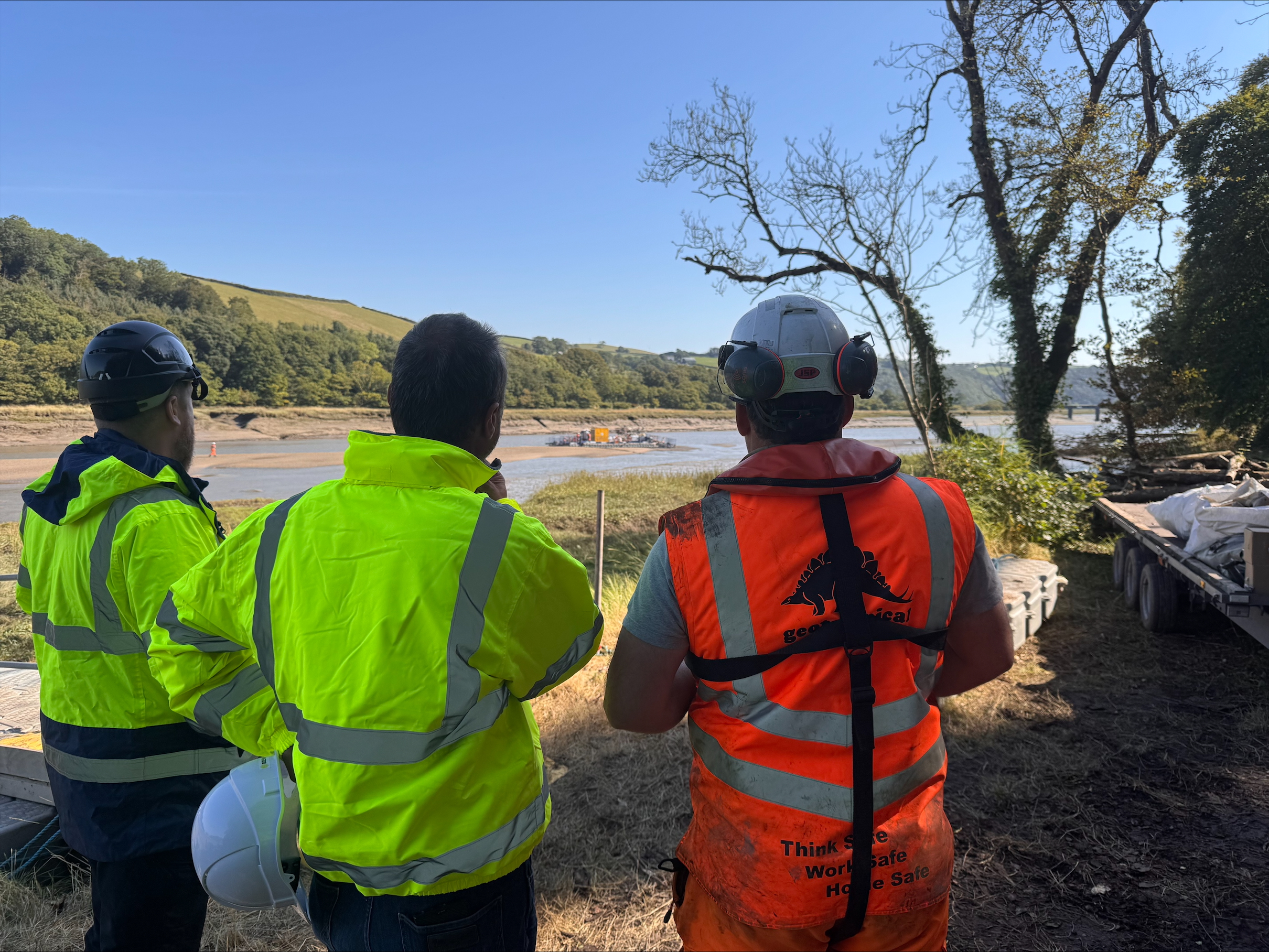
We’re currently carrying out ground investigations to inform our detailed plans for onshore cables in Devon. Part of the survey includes drilling two boreholes in the River Torridge just downstream from the Iron Bridge.

We expect to do this between Monday, 9 September 2024 and Monday, 23 September 2024 using a floating pontoon with the borehole equipment on board.

People walking or driving nearby may be able to see the pontoon between these dates. You may also be able to hear the drilling at times, particularly when we test certain layers of strata. We’ll work carefully to minimise impacts from light and noise during the work.

We have begun constructing the pontoon at the slipway off Torrington Street, East the Water and we’ll use a crane to lift the drilling rig on to the floating pontoon from the Little America lay-by.

The lay-by at the location shown below will be closed for this on Monday, 9 September 2024 and Monday, 23 September to facilitate the crane lift.

One lane of the A386 will also be closed to facilitate the works. There will be two separate lane closures:

  1. On Monday, 9 September 2024 and Monday, 23 September 2024, the southbound lane adjacent to the lay-by will be closed with 2-way lights. This lane closure will be on for the whole working day to facilitate a safety zone for the crane lift.
  2. Between Monday, 9 September 2024 and Monday 23 September 2024, there will be a set of 3-way lights at the junction between the A386 and the junction to Littleham to facilitate access to the riverbank. This closure will be on intermittently throughout the works and we will endeavour to have it on as little as is feasible for the works.

The works are subject to the tidal variance of the river. The pontoon will float, and bottom out depending on the tide times and will require a presence on the pontoon 24hrs a day and drilling will be required to take place subject to/in line with the tides.

Thank you for bearing with us during this work.

Frequently Asked Questions

Our project needs to connect at the optimal location in terms of transmission capacity and efficiency. This means it can deliver more renewable energy at a lower cost to Britain’s households.

We worked with National Grid to identify the optimal connection site. Agreement has been reached with National Grid for two 1.8GW connections at this site.

We are committed to explore all opportunities to contribute to social and economic development in Devon, including through the tender of work packages during the construction of the project and through the establishment of a community benefit fund.

It is our priority to be a good neighbour to Devon’s communities and natural environment. We aim to deliver a net positive environmental impact for biodiversity.

Finally, our project represents nationally-significant action in line with the principles of the Devon Climate Declaration.

All cables will be installed underground, with land reinstated to its previous use. There will be no permanent infrastructure above-ground along the route.

At the converter station site, the design process will use substantial screening to minimise visual impact.

Post-construction noise will be minimal, with very few moving parts, occasional inspections and maintenance, and a small operational team.

We will seek to minimise disruption to local roads during construction by transporting large, infrequent, converter station components from a local port by road at the lowest point of traffic density. We will use construction haul roads along the underground cable route to remove frequent vehicle movements from the public highway. Additionally, materials will be transported to strategically located compounds adjacent to the A39, A386 and Gammaton Road.